I looked up some videos on YouTube about climbing Mt Hallasan on Jeju Island, South Korea’s highest mountain at 1, 950 m. It seems most agree that it is not an easy climb. The ascent and descent together is about 18 km in total and the average person would take an estimated 10 hours.
My first reaction was surprise at the elevation. Korea has many mountains yet their highest is only 1,950 m. This cannot be compared with Mt Kinabalu in East Malaysia which is 4,095m high and I have hiked there several times. By comparison, Hallasan should be doable.
However, as the day drew near my anxiety increased. I hardly could train as I had originally planned. Saturday church ministry meant I was available for training intermittently. Thus, I tried to squeeze in some training on days and times different from the rest of the Saturday hiking group. I did make sure I had at least one endurance training which went from 7.45am to about 12.45pm. I remembered how a lack of training ditched one of my earlier group hikes in Hong Kong on the MacLehose trail. And I was not as young as before when I did my earlier hikes up Mt Kinabalu. What made things worse were weather forecasts of cold weather! That worried me as I hated cold!
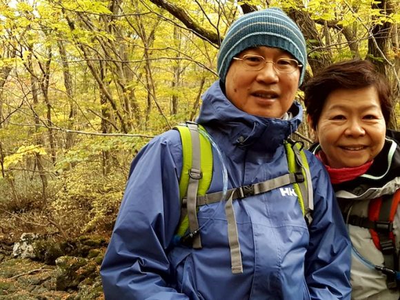
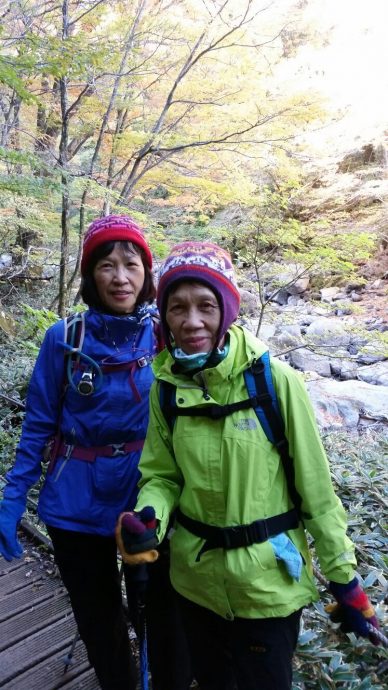
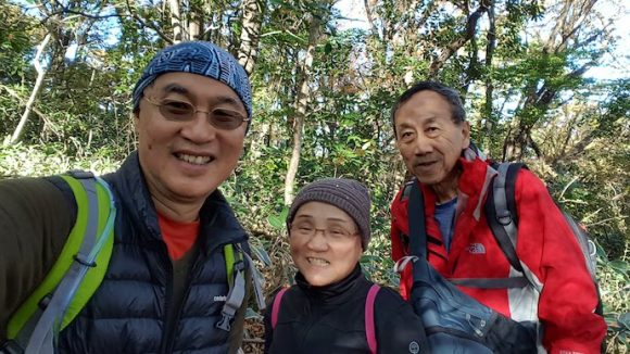
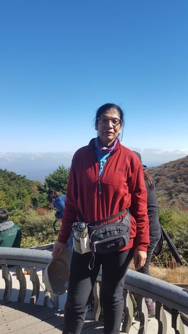
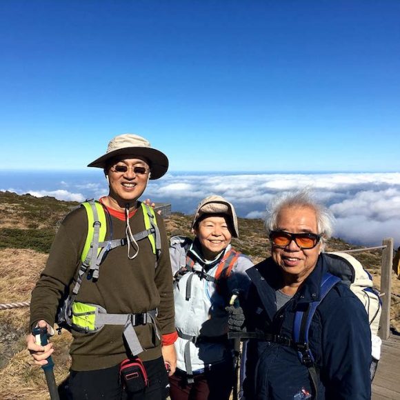
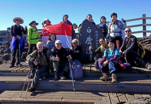
When the group gathered together at the airport most of us knew each other. Some of us had hiked together for years. Others were new. The oldest was Jenny Teo, 75, the leader’s elder sister. The youngest was Eunice Lian, about 23. Most of us were in their 60’s including me. With mixed ability and levels of training, the challenge was obvious, “How can we keep the group walking and summiting together?”
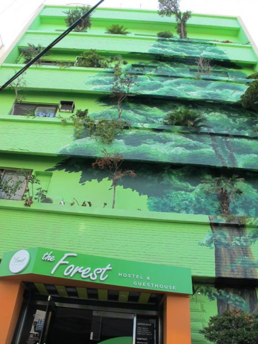
It was good we had a few days in Seoul to relax and carbo-load before the climb. I will blog about our days in Seoul in a later blogpost. We took a Jeju Air one hour flight to Jeju island and settled into the Forest Hostel. The weather was often on our mind, so we flashed our requests up to God about this.
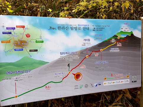
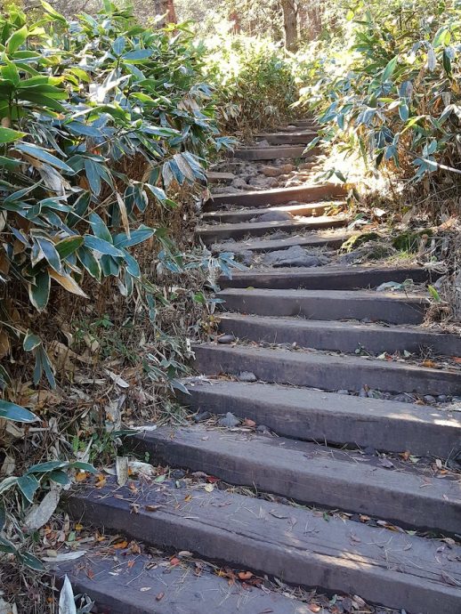
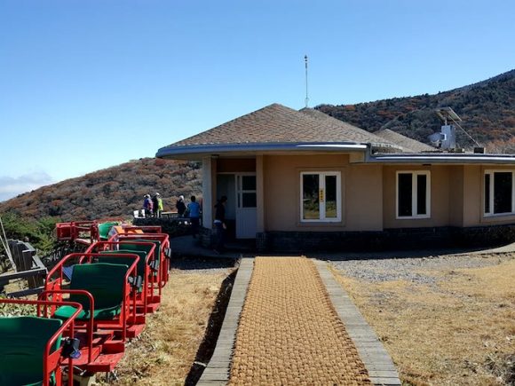
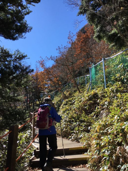
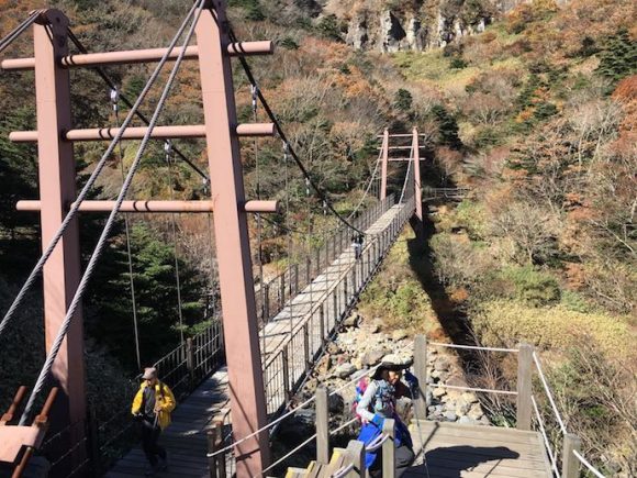
We decided to take the difficult Gwaneumsa trail (8.7km) up, and the easier Seongpanak trail (9.6km) down. We started our hike early at 6.45am. We wanted all in the group to be able to make it by the time fixed by the park. For safety sake, they turn back hikers who cannot make it to the three quarters point by a certain time. So the leader, Linda Teo, appointed Brian to be at the front and nobody was to overtake him. He would pause and regather the group at various points up the route. She took the rearguard. The route was straightforward and no guides were required.
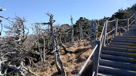
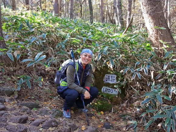
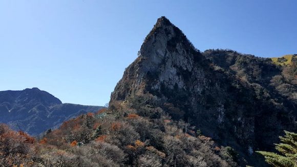
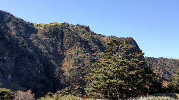
As light gradually shed its rays on the forest we saw how beautifully the valleys were dressed in their lovely autumn colours, set in the midst of grey rocks and dried stream beds. Taking our time to enjoy the sights and take photos, the hike seemed quite leisurely during the early part of the hike. And I was thanking God for the fine weather: it was not as cold as weather reports predicted! The terrain and vegetation changed as we hiked up the route. We paused to drink, snack, take pictures, use the toilet and to regather the group.
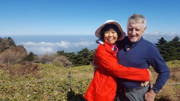
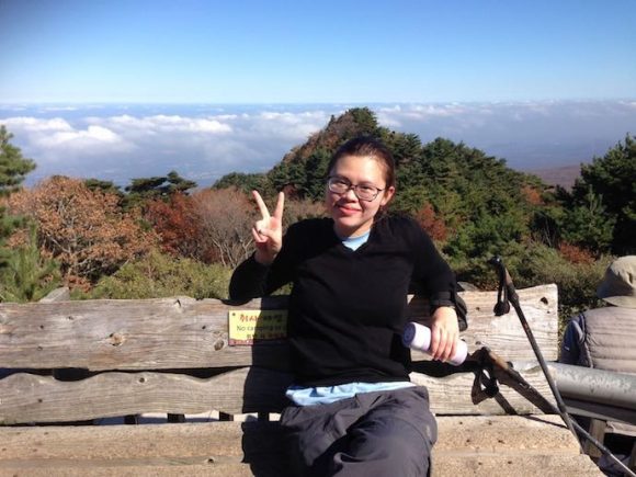
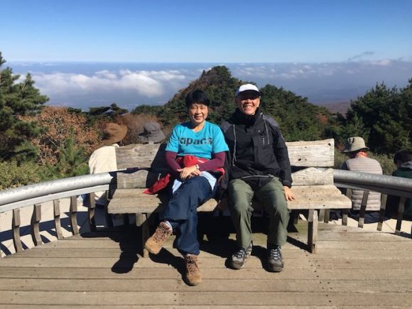
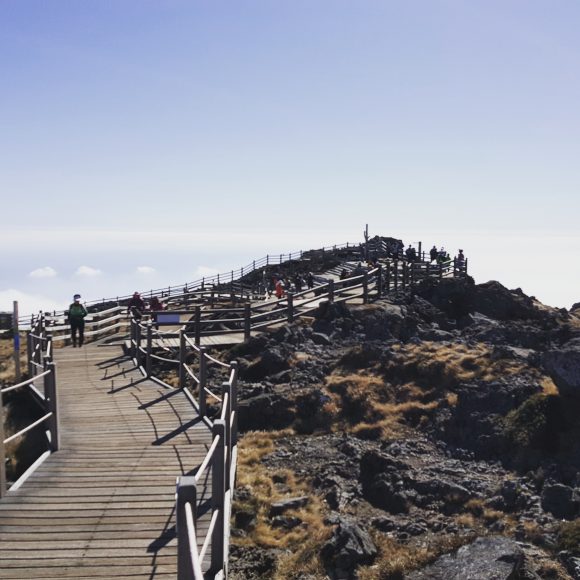
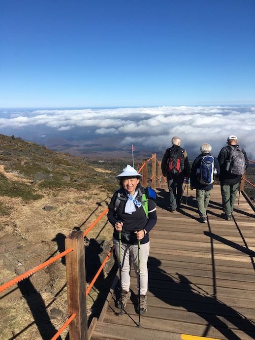
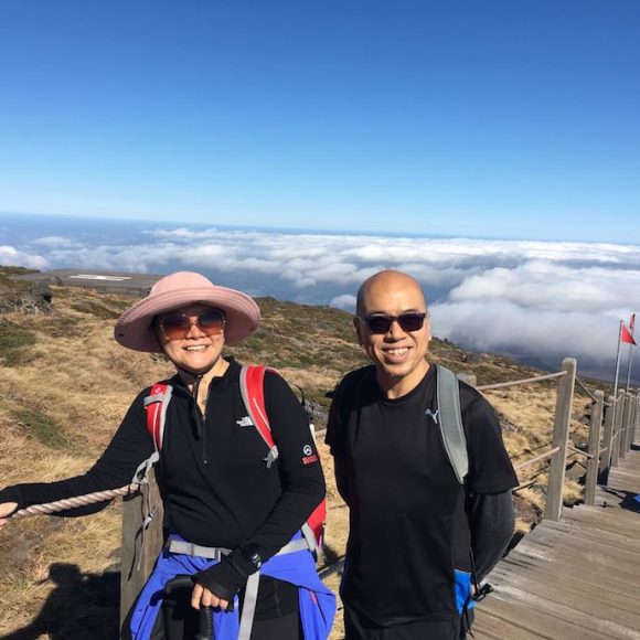
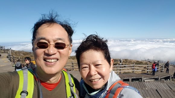
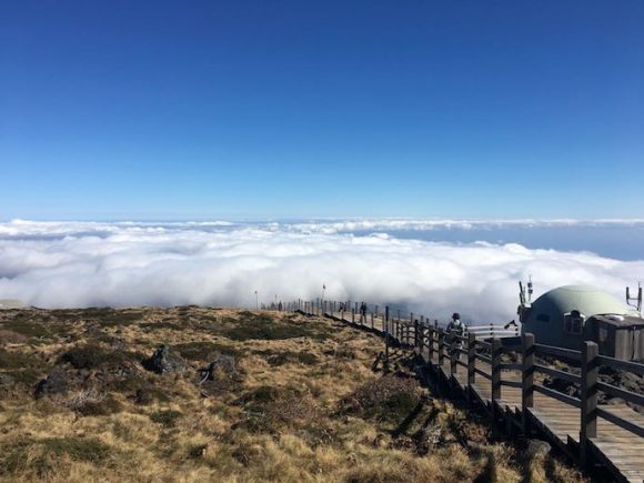
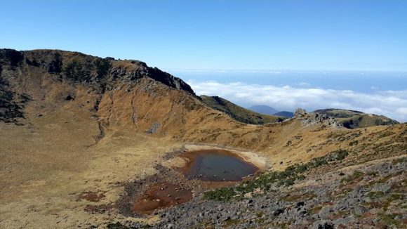
The last stretch was deja vu for me. It felt like that last stretch before we reached the Laban Rata rest house at Mt Kinabalu. All of us made it on time except for a lovely couple who did not meet the time requirement. They were advised to go back down the same route. Later, when they heard stories of the rest of our hike, they were glad they were turned back. It would have been impossible for them to ascend to the summit and down the trail without great difficulty. By the time they were turned back, the rest were already hiking the last uphill climb to the summit. It would be another hour and a half before we reached the summit at about 1 plus. Someone brought a Singapore flag and we took photos and looked around the summit, peering down the crater lake (more of a pond), and the cotton clouds below us.
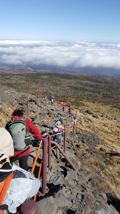
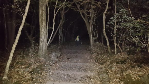
Then the mountain ranger hurried us off. We were at risk of hiking in the darkness if we did not hurry. Darkness fell early at about 6pm. We raced down even though we carried LED torches with us. If we could, we would rather not hike in the dark on uneven stony paths. By 5.30pm it was already dark. We reached the car park at about 6.45pm. Others in the group returned later. I thanked God for Beng Chai and Brian, who helped one of the hikers, who sprained her ankle at the summit area, down the trail at her pace. When all were in the bus, we were happy to return back to the hostel with a great sense of satisfaction, and exhaustion. I was so thankful to God during the climb for the fine weather and the strength to summit and descend safely.
Very impressive writeout. I would like your description and feeling of the difficult journey down, especially the rocky terrain.
Hi Simon, the journey down was difficult because of the many rocks and stones. We had to place our already tired legs and feet upon the right rocks and elongate the trekking stick so it cushion the impact on our knees. We felt a sense of urgency because we were trying to avoid the darkness. In the end, we were not able and walked with torches for the last 45 or more minutes. We felt relieved when the driver greeted us. He came up to look for us!
Hi! How many layers did you wear for the hike? What should I wear since I’ll be going there around the same time as you.
Hi Eric, I wore a long sleeved quick-dry, a cashmere sweater, and a windbreaker. Carried along gloves and scarf too. Happy trekking!